Tuesday, May 21, 2013

Miter Basin, July 2012, Day 9


Day 9: Upper South Fork Lake to Cottonwood Lakes Campground, or It’s All Downhill From Here (5 miles)

Upper South Fork Lake proved to be a good camping spot for the last night of our trip. We were up early and ready to hike by 8:00 in the morning, and by 10:00 we were at the trailhead. 

Cottonwood Lakes Basin.

The trailhead parking lot was much less crowded than it had been when we left, but the trail was still all buggered up with people. Most of the folks that we met were day hikers, although quite of few of them could have been hiking in for a week or more, given that their backpacks were larger than a lunch sack.


Shortly after we started hiking, we ran across a couple of guys who were resting by the side of the trail. What was striking about this pair is that they were young (early twenties, tops), but they were carrying full-size backpacks, maybe 70 liters capacity. That’s the same size as my pack.

“How long you going in for?” I asked, as my companions kept on hiking.

“Just over two weeks,” one of the guys replied. “We’ll make it to Miter Basin today, and we hope to climb Whitney tomorrow. If all goes well we’ll be in Yosemite before our food runs out.”

Two weeks to Yosemite seemed mighty ambitious to me, and I said so.

“Yeah,” the guy continued, I know what you mean. This pack is killing me.” He looked over to his friend who was nodding in agreement. “I mean, it weighs almost 34 pounds, including water, but I got almost 20 pounds of food.”

“You were able to fit 20 pounds of food in a bear bin?” I asked, incredulous.

The two guys smiled. “We’re not carrying bear bins. We plan to sleep with our food, and we’re prepared to defend it from bears if we have to.”

Now, I’ve seen bears peel back the outer skin of a car door with their bare paws to get inside. These two guys were young and athletic, but I’m thinking a bear could take them. So I said so. They were pretty sure that a bear couldn’t. We talked for a while longer, and when I turned to go, one of the guys said, “Hey! Is that a chair on the back of your pack? That is so cool!”

“Yeah,” I said proudly. “It’s the best backpacking chair you can find.”

The two guys looked at each other, one of them said, “Wow, those guys carry chairs. Man, I hope I’m never that old.”

“You keep baiting bears,” I said back, “and you won’t ever be.”

“You got that right,” the young man retorted. So we parted company, with those on both sides of the debate feeling just a little bit smug.

We were all very glad to reach the trailhead, which was somehow much further than we remembered. Light packs certainly help, but no matter what, there are no shortcuts when the shortest route to the car is five miles, and the last two miles are always a lot longer than they seem on the way in. 

The last two miles are the longest.

Our experiment with lightweight backpacking had been a great success. We didn’t do anything that we couldn’t have done with heavier packs, but I don’t think anyone missed the things we left behind. I am sure that there is still more that can be shed. Packing light is a process, the goal being to carry only what is truly needed. We will never be those guys whose pack for a weekend trip weighs 10 pounds. When the MountainGuys do lightweight backpacking it’s a lot less light than it could be. We carry chairs and sit in them at every opportunity. 

Still smiling. Our packs must be very light,


Monday, May 13, 2013

Miter Basin, July 2012, Day 8


Day 8: Milling About in the General Vicinity of South Fork Lakes, With a Side Trip to Cirque Lake (3 miles)

Our decision to stay at Upper South Fork Lake was one of convenience, putting us about five miles from the trailhead for our hike out on the last day, but it was also a stroke of good fortune. From the Cottonwood Lakes trailhead, there really aren’t that many places one can go on the east side of the ridge. The Cottonwood Lakes are the place where most people go, probably because the Cottonwood Lakes are quite pretty and the South Fork Lakes much less so.

Nice camping at Upper South Fork Lake. (Photo ST)

Upper South Fork Lake is really more of a pond, or perhaps a sump, than it is a lake, and by the end of summer it may be just a damp spot on the ground. There is a small stream that feeds into the lake from the mountains above, but the catchment area is small, and the stream was barely flowing at the beginning of July. Curiously, the South Fork Lakes are a separate watershed from the Cottonwood Lakes. Their headwaters share the same basin below New Army Pass, but a small spit of land separates Upper South Fork Lake from Long Lake, though they are only a few hundred yards apart and at about the same elevation.

To the south of Upper South Fork Lake is a long, low shoulder of crumbling granite that juts out from the ridge below Cirque Peak, and on the other side of that shoulder is Cirque Lake. With one more day to enjoy and no real reason to move camp—other than the sheer joy of packing and unpacking—we decided that a third lay-over day was just the ticket. Cirque Lake offered a unique combination of promise and proximity that made it a must see destination for a short but vigorous day hike on an otherwise kickback day.

The climb to the top of the low shoulder of crumbling granite did not take long, perhaps 15 or 20 minutes, which, even by our decidedly unambitious standards, was not enough. From the top of the shoulder we had an excellent view of the lake and of the cirque surrounding it. Cirque Lake is very pretty, and had we known we might have been tempted to move. There is one good camping spot on the northwest side of the lake, and several sites in the meadow below the lake on the eastern side that would have been okay. On the western side of the lake, the ground slopes very steeply up toward the high ridge and Cirque Peak. Across the lake on the southern side was a well-defined glacial moraine hanging about midway between the lake level and the high ridge behind.

“Maybe we should go explore that moraine,” Snow Toad suggested. “See how it slopes down the lake level? We could just follow it down and then explore the lake.”

No one had a better plan, so we agreed to go explore the moraine. The only question was how to get there. Climbing down to the lake level and then back up would have been the most sensible route, but sensible is for lightweights. We might have committed ourselves to the principles of lightweight backpacking, but we had not adopted lightweight sensibilities. No, climbing down would require climbing back up, and a more direct route, scaling the cliff face above the western side of the lake, was available. So it was settled. We would go explore the moraine, and we would scale the cliff face to get there.

The easy way across.

This was one of those things that made more sense while standing securely atop a rounded mound of crumbled granite than it did as we clung to the rocks, fly-like, suspended two-hundred feet above the lake. But after the first few steps—which included squeezing between two big rocks, sliding carefully down a steep, slick chute, jumping over a narrow ravine onto a broad patch of deep sand, and then carefully wading through the sand while hoping that it would not all start sliding down the mountain—we were committed. Without knowing what lay ahead it was easy to imagine that it had to be easier than turning around and jumping from deep sand over a narrow ravine and into a steep, slick chute. It wasn’t. Our reward for crossing the deep sand was an opportunity to scramble across scree-covered rocks, around a loose boulder that Oliver nearly dislodged, and onto a narrow shelf that allowed us to shimmy past a 20-foot vertical cliff. Once past the cliff, we found ourselves perched on a broad flat rock with an opportunity to relax for a moment before continuing. From there, Oliver and Snow Toad charted out an excellent path that had us fighting our way uphill through prickly bushes that were all growing downhill, carefully sidling along a another little ledge and around a big tree that was growing right on the edge, up through a sand-filled chute, and then across a large, smooth, sloping rock surface that was suspended above a 30-foot fall and lubricated with sand. All in all, it wasn’t too bad, and clearly better than hiking all the way down and then all the way back up.

Cirque Lake.

The moraine was hardly worth the effort. What looked to be an easy stroll from across the lake proved an arduous exercise in bouldering once there. The entire moraine was a giant jumble of large rocks, which makes sense once you sit back and think about it. But we hadn’t sat back and we hadn’t thought, so there we were. No matter what direction we set out in, we had to climb up, down, or sideways to get there. Our goal of exploring the moraine was laudable, even noble perhaps, but the MountainGuys do not award badges for nobility, and it was nearly lunchtime, so we abandoned the moraine and climbed down the lake.

The moraine looked more inviting from afar.

Water flows out of Cirque Lake at the eastern end, through a broad meadow, and eventually into South Fork Creek. The entire eastern shore is shallow, with a fine little sandy beach. The breeze was blowing cool off the lake, but we found a large, black rock to lean up against and it was plenty warm in the sun. From our lunch spot we had an uninterrupted view of the cliff face we had climbed across earlier, and had to admit that it looked pretty dangerous. Of course that filled us with a sense of pride in our mountaineering accomplishments. But proud as we were, we knew where the real danger lay, so we also took a sacred vow not to share the details with our wives and girlfriends.

Our path took us across the top of the sand chute. (Photo ST)

Lunch spot.

There are three lakes in the South Fork Lakes. The upper lake is more of a sump than a lake, and the middle lake is little more than a vernal pool. The lower lake is small, but genuinely lake-like, with deep blue water that sparkles in the sun.

There is a semi-maintained trail from the lower lake to the Cottonwood Creek trail, and it’s a pretty good bet that the semi-maintained trail continues on to the upper lake, even though it wasn’t shown on our map. But no matter, we were in off-trail mode, so when Oliver suggested we hike up South Fork Creek to get back to camp, none of us so much as hesitated. We should have. From the trail the hillside sloped steeply down to the lake. A few lousy campsites had been established on the flattish spots, but one would always have to beware the risks of rolling out of bed and all the way down to the water. Hiking up the stream was a lot like hiking on the moraine—large boulders blocked our path in every direction, and every step had to be carefully planned to avoid rolling a stone over and ending up underneath it.

Hiking up South Fork Creek to camp.

Upper and Lower South Fork Lakes are separated by only half a mile, but the hike up the creek took almost an hour. Leaping from boulder to boulder is fun for the first 200 leaps (give or take), but after that it is just tiring. So when we finally crested the rim of the upper sump at about 2:00 p.m., we are all exhausted and grateful. Snow Toad was painfully behind in his “chair time,” Oliver and Rick (well, Oliver anyway) were looking forward to playing golf, and I was anxious to fish. This was our last afternoon in the wilderness, and there was still so much to be done.

Although Upper South Fork Lake was a very modest affair, it did have one very important feature: the fish were ravenous and feeding on the surface pretty much all day long. I had done some fishing the previous afternoon, catching at least ten fish, all on mosquitoes and ants. The ants worked best. But I had not kept any of them because I didn’t feel like cleaning and frying fish in the rain. On this last day of our trip, I was determined to catch the biggest, plumpest fish in the whole lake and eat them. I even had the temerity to tell my companions of my ambitions. You can imagine their surprise when I walked into camp with two big, beautiful golden trout, and after catching about 25 fish, I can say that these were very likely the biggest fish out there.  

I fried the fish in a little oil and carefully removed all of the meat from the bones. Between us, Oliver and I had two extra tortillas, so I fried those up one at a time, threw on some cheese and some fish and some hot sauce, and made fish tacos as an appetizer. These were so good that Snow Toad couldn’t help himself and even had a bite. For my efforts I was awarded the Golden Taco Badge for high achievement in wilderness fish taco cuisine.

Dinner that night was curried rice with salmon and vegetables. And even though we were committed to the whole lightweight thing, on this last day we had to have a complete three-course meal, including raspberry crumble for dessert. Snow Toad, however, had recovered his equilibrium, settling back down after his brush with fish taco exuberance, and had ramen.

Resting easy at the end of the day.

As always the last night was a bittersweet affair. I drained the last of my scotch, and Oliver his tequila, as the four of us watched a lightning storm out over the Owens Valley more intense than the finale of even the biggest fireworks display. The lightning flashes lit up the towering thunderheads, crackling off with barely any break for more than an hour. Overhead we had clear skies and bright stars. The lightning show was dramatic and exciting, and we were all really glad that it was 15 miles away.

Monday, May 6, 2013

Miter Basin, July 2012, Day 7


Day 7: Miter Basin to Upper South Fork Lake, or It’s Not Really as Steep as It Looks
(8 miles)

Rain showers came and went throughout the night. When the alarm went off at 5:30, the sky was just getting light through a thick layer of low, gray clouds. Fortunately, the showers held off while we were breaking camp and making breakfast, and by 7:40 we were on the trail. 

On the trail out of Miter Basin.

Upon leaving our campsite in Miter Basin, we had several options to reach the trail to New Army Pass. We could retrace our steps to Middle Soldier Lake, but none of us was anxious to climb back up to the ridge through all that sand. We could hike down Rock Creek, and pick up the trail well down the valley by a small lake with no name. Or we could hike to Lower Soldier Lake and pick up the small spur trail that ended there. This last course required that we navigate along the 11,000 foot contour line and then climb down a steep cliff to the lake level about 400 feet below. Since this last alternative did not involve climbing up sand or hiking down an extra 400 feet of elevation only to hike back up, and also included the potential for an extremely dangerous scamper down a cliff face, this was really the only alternative that we considered.

Following the 11,000 foot contour line.

The hike to the edge of the cliff above Lower Soldier Lake was brilliant. From the open rock of the Rock Creek valley, we soon found ourselves hiking through small meadows and a mature forest of foxtail pines. Our already light packs were lighter still after three days of eating and drinking, and we were feeling good about getting back on the trail. Following a contour line is not difficult across open terrain, but it gets more complicated in the trees and over uneven ground. We made good time until we got into the trees, at which point we split up, each man following the path he thought best. Without question, mine was best, although Rick probably would not agree, and Oliver and Snow Toad would refuse to comment. Despite our fundamental disagreements about the proper path, we all found ourselves perched atop the cliff above Lower Soldier Lake at about the same time, each of us vexed about the next step.

“There’s the lake,” said Oliver.

“That’s a pretty steep slope.” Rick gave voice to what we were all thinking. “One false step and one of us could die.” Rick has a way of lightening the mood in every situation.

Rick contemplating mortality.

“I don’t want to die,” I said, peering over the edge. “We should be very careful.”

“Well, if you do,” responded Snow Toad, “don’t expect any of us to follow your example. But I think we can do it.”

With that, Snow Toad started down the slope, Oliver close on his heels. Rick and I held back, waiting for them to get clear ahead so that any stones we might set loose would not pummel them about the head and shoulders. Although steep, we were able to pick our way down the mountain without too much trouble. At one point Snow Toad climbed himself out to the edge of a 20-foot vertical drop and had to turn back, but he was forthright enough to announce his mistake before any of us could slam into him from behind and accidentally push him over the edge.

From there, Oliver took the lead in climbing down. I am always leery of following a trail that Oliver is blazing because his natural athleticism enables him to do things that mere mortals cannot, and when a stone gave way beneath him, causing him to glissade down a smooth granite slope for about ten feet, I had real doubts about his chosen path. But the little chute he had been climbing down was still the best path, so we followed carefully, hoping to avoid his sliding maneuver that surely would have been the end of the rest of us.

We each breathed a sigh of relief upon reaching the bottom, congratulated one another, and in a moment of shameless self-adulation, agreed that we were all worthy of a Billy Goat Badge. And why not? With no one else around to celebrate our modest achievements, it was up to us to do it.

Lower Soldier Lake is a beautiful lake, set in a deep bowl of carved granite. Like many of the places we had been, though, the camping was mediocre. Most of the spots were too close to the water, and the best spots, down by the outlet where the stream flowed out of the lake, were restricted for habitat restoration. But as is frequently the case, some excellent camping spots could be found just a short ways down the trail along the stream. Lake camping is always nice; stream camping is often better.

Cliff of Doom from a distance.

A little bit of success is a heady brew, and we were riding a success high. You might even say we were feeling cocky. After all, we had successfully followed the 11,000-foot contour line, we had successfully negotiated the cliff above Lower Soldier Lake, and we had successfully positioned ourselves within three miles of New Army Pass. The sun had come out from behind the clouds, and with Lower Soldier Lake behind us, we were now hiking on level trail through trees with an occasional view down the Rock Creek valley. With all that sun and all that success, we could not help but anticipate clearing the pass before storm clouds returned. 

To the Pass!

But success is also ephemeral, and 2.3 miles of uphill, starting at 10,880 feet and climbing to 12,310, will severely tax all but the headiest of brews. Our brews were not that heady. The trail is well graded, a brilliant piece of engineering, really. The views are spectacular, which helps, and the headstones, presumably honoring those that have died while seeking the pass, are a cheery touch. But 2.3 miles is a long way to go uphill, even with packs as light as ours. The clouds began to drift back in about the time we started the climb, and by the time we reached the pass itself, the sky had taken on a menacing, gray pallor. Lunch would have been welcome, but getting off the pass was more welcome still. Unfortunately, events would conspire to prevent us from reaching camp before the weather arrived.

Headstone.

Rick reached the top of the pass first, and by a wide margin, demonstrating the determination that makes Rick the man he is. If there is a job that requires beating one’s head against a wall until the wall gives way, then Rick is the man for the job. He does not go about this business in a flashy way, and while he is beating his head he will tell you all the reasons why doing so is less than optimal. But he will outlast the wall. His past is littered with crumbled walls, his present colored by a bruised forehead. Once he started climbing he would not stop, and for his determination, he was awarded the Keep Pounding Away Badge.

But Rick’s long stay at the top of the pass would also make the events that followed that much more remarkable. For one of the interesting features of his overstuffed and misshapen pack is that for all its overstuffedness, still not everything fit inside. He has shoes tied to the outside, and a jacket looped under the hood, and a cup and a bell and a whistle, and just for good measure, his sleeping bag is also strapped outside his pack. As many of you know, the sleeping bag is a critical piece of gear, and its loss could be uncomfortable and perhaps even tragic. But for some reason, on this one occasion Rick neglected to check the strap tension on his sleeping bag, even though he had plenty of time to do so. Maybe it was the elevation and the thin air, maybe he was gassed from the climb, or maybe he was too busy eating snacks. But whatever the case, the sleeping bag parted company from the pack shortly after we started down the eastern side of the pass.

Oliver was out in front, as he usually is on the downhills, and Snow Toad was not far behind. Rick and I were hiking together about a hundred yards behind them. We were all going fast. The wind was picking up, and we could feel the moisture rising in the air. We would get rain, and we did not want to be out on an exposed rock face if the rain was accompanied by lightning. So when we came to a particularly sharp switchback, Rick swung around the corner like a driver in Le Mans, his heavily cantilevered sleeping bag whipping through a 180 degree arc in a fraction of a second. I was hiking behind him, and I watched in fascinated horror as the sleeping bag hurtled through the air in its dirt-brown stuff sack, and down the steep slope.

“Rick! Stop!” I shouted.

Rick turned around. I pointed to the sleeping bag, which was still bounding down the hillside, bouncing off rocks, and finally coming to rest under a large square boulder, easily distinguished from all the other large square boulders as long as we did not take our eyes off of it for a second. So what Rick should have done is dropped his pack right then and there and climbed down to get the sleeping bag. But the slope was very steep, and from where we stood, it looked as though climbing up from the trail below would be much easier than climbing down from where we were. So we did our best to take bearings and identify features that would uniquely identify this square rock from all of the others, and then we headed down the trail after Oliver and Snow Toad.

Rick was pretty well panicked by the time we reached to turn for the next switchback, and as we gazed up to the peaks to get our bearings, we realized our error. Every square rock looked the same, the unique features of “our” rock washed out in the completely different perspective we now had from down below. We hastened down the trail, trying to estimate how far we had hiked on the previous switchback, and finally, when he could stand it no longer, Rick threw his pack off, and started climbing up the hill. His path was random, as he slowly picked his way across the steep rock slope, looking for a dirt-brown bag amidst a field of dirt-brown rocks.

By now Oliver and Snow Toad had realized that something was amiss, so they pulled up and waited for us about 200 yards down the trail. After ten minutes of watching Rick engaged in his fruitless search, I did what I should have done ten minutes earlier: I hiked down to where Oliver and Snow Toad had stopped, explained what was going on and opened a betting line on whether or not Rick would find his bag.

“I don’t think he’s going to find it,” said Snow Toad.

“That’s going to make for an uncomfortable night,” added Oliver.

“The line is now 62 to 1 against finding the bag,” I noted. “Any more bets?”

“I like those odds,” exclaimed Snow Toad, “here’s another dollar.” He handed me a crumpled bill. “You know, if he doesn’t find that bag, we will probably have to hike out a day early.”

“That would really suck,” said Oliver. “Maybe we should help him find it.”

“Give me my money back,” Snow Toad demanded. “I don’t want to hike out early and I don’t like to bet against my own interests.” I reluctantly handed Snow Toad his money back. I had no doubt that Rick was going to find his bag, because he was going to comb every square inch of the mountainside until he did. It was just one more wall that would eventually crumble from him beating his head against it.

Rick did find his sleeping bag, but not before he had climbed all the way back up to the trail above. After I reminded him that the bag came off when he went around the corner, he followed the trail back up to the next switchback, and then climbed down the steep slope to the big square rock, just like he should have done in the first place. The whole episode had taken at least 30 minutes, but it was not a complete waste of time. We learned some important things. First, we learned that it is very important to tie one’s gear securely, especially if it is a critical piece like a sleeping bag. And second, we learned that even at 62 to 1, no one was willing to bet against Rick’s hardheaded determination.

The weather continued to deteriorate while Rick was conducting his search, and the rain started to fall before he finished. This was not a hard rain, but enough to encourage those of us who were just standing around to put on a jacket and to cover our packs. Fortunately, we did not get any lightning, although we could hear an occasional thunderclap on the other side of the pass. The sound of thunder is a real motivator, so we motored down the trail until we got past High Lake, and almost down to Long Lake. Most of this terrain was still out in the open, but we were well off the ridge and still we had not seen any lightning on our side of the mountain.

We had hiked for about seven miles from our campsite in Miter Basin, the last four and a half on the trail. Our goal for the night was Upper South Fork Lake, and from the map it looked as though we could bypass the last bit of trail and go cross-country directly to the lake. This proved to be a bad decision. We quickly found ourselves hiking in a dwarf forest of foxtail pines and junipers, through thorn-covered bushes while picking our way over crumbled rocks the size of bowling balls. The rocks were sharp-edged and irregularly shaped, so each step was a sprained ankle waiting to happen. Oliver eventually got so fed up with our direct path to the lake that he abandoned it in favor of a longer route through a boggy meadow on the south side of the lake. The rest of us stuck it out a bit longer, but for no good reason, so we eventually followed Oliver down to the meadow. 

Stunted forest, thorny bushes, rocky path.

The rain, which had stopped while we were passing High Lake, now returned, this time with a bit more conviction. The dwarf forest had evolved into a forest of greater stature, but the bushes amongst the trees were no less thorny, and the ground no less rocky. The camping in the trees was just plain shitty, and the meadow, while soft underfoot, was lumpy and increasingly bog-like the closer we got to the lake. When we finally found a small flat spot on the edge of the meadow that was not covered with sharp rocks, our joy was entirely out of proportion to the quality of the site in question. But it was a flat spot, we could have found a way to fit our tents, and we were prepared to make do. Fortunately we did not have to. Before committing ourselves to camping in such a lousy spot, we decided to scout out the forested area adjacent to the lake a bit more thoroughly, and found some great camping up in the trees away from the meadow. The site was well used, and even offered excellent access to the main trail, just 150 feet away.

The rain came and went through the afternoon, including a downpour for about 15 minutes. But the showers cleared before sunset, leaving behind clean, pine-scented air, brightly colored clouds, and an opportunity to kick back in the kitchen area while Oliver made dinner. On the menu were bean and cheese burritos with chicken and onions fried in olive oil. Snow Toad had ramen.

Sunset over Upper South Fork Lake.

Tuesday, April 30, 2013

Miter Basin, July 2012, Day 6


Day 6: Lay Day Number Two, or The Hanging Gardens of Primrose Lake and the Lagavulin Highlands (3 miles)

One of the interesting features of Miter Basin is its isolation from anyplace else that is anywhere near as interesting. Mt. Whitney is two days away, the Kern River is two days away, and anything worth seeing in the Golden Trout Wilderness is probably also two days away. From our campsite in the trees below Sky Blue Lake, our choices were to hike over Crabtree Pass and down to Crabtree Meadow, which we had already decided not to do, to hike back toward the trailhead and tour some of the small lakes on the other side of New Army Pass, or to hang out one more day and explore more of Miter Basin. In a wetter year the Golden Trout Wilderness might have been a more interesting alternative, but the Golden Trout is all stream camping, and we weren’t sure how reliable the water would be. So this wasn’t a hard choice. Miter Basin was the coolest spot around, and we were already there.

When we awoke that morning, the sky was cloudy, and it was a good bet that we were going to see rain before the end of the day. Under the circumstances Primrose Lake looked to be a fine day hike, offering a little bit of challenging climbing, an intriguing destination, and the chance to take a nap in the afternoon.

From our campsite, Primrose Lake was just a short stroll down the Rock Creek Valley, a nice little climb up Primrose Creek, and then we’re there. In fact, we arrived so quickly that none of us were really satisfied by the effort. 

Nice little climb up Primrose Creek. (Photo ST)

“We could climb to the top of the green,” Oliver said, pointing to the far end of the lake. A small stream flowed into the lake from the valley above, and the area around the stream was an oasis of green with bright wildflower highlights in the otherwise gray landscape of tumbled rock and steep cliffs. 

Primrose Lake. (Photo ST)

We all agreed. The scramble around Primrose Lake was easy, although there were a few spots that required clambering in, around, and amongst the boulders that lined the lake. As we hiked around, I kept one eye peeled for fish. I finally did see one, a pretty golden trout, plump and maybe ten inches long, lounging around right where the little stream entered the lake. It was easy to see why this one was so big and fat—she got first dibs on anything washing down the stream. In the minute or so that I was watching, I saw a smaller fish try to sneak into her little pool, but he took off when he realized that he was more likely to be lunch than to get lunch.

Primrose Lake is a pretty lake, with soaring spires of crumbling rock along both sides. At the far end a series of hanging valleys disappear into a jumbled moraine below the cliffs that line the head of the valley. The camping at Primrose Lake is rocky and exposed, but better than Sky Blue Lake. Flat ground extends for several hundred feet at the lower end of the lake, and there are plenty of spots where one could set up camp without running afoul of any pesky environmental considerations. Nonetheless, there was nothing there that cried out for an extended visit, or offered enticement for a return trip. 

MountainGuys at Primrose Lake.

The climb “to the top of the green” at the upper end of the lake was steep, but no more dangerous than anything else we had been doing, and probably a good bit safer than Oliver’s cooking. We were climbing not because of inspired vision or high expectations, but for lack of anything better to do. So we were unprepared for the mystical enchantment of the Hanging Gardens of Primrose Lake and the Lagavulin Highlands.

At the top of the green was a most wondrous garden of meandering watercourses and green tundra, of boulders hewn from the mountain in stark geometric shapes and arranged for dramatic effect by God’s own hand. This was a place that inspired philosophical reflection and joyous revelry in the wonderment of the natural world. It was a place where one could find clarity and peace. So naturally we did not dare stay long. Wonderment and revelry are terrific, but philosophical reflection is a heavy burden, and clarity and peace are simply too far beyond the writ of the MountainGuys. 

Hanging Gardens of Primrose Lake.

The green continued up the mountain to the next little hanging valley, and our mission was to climb to the top of the green. So we continued on. The next little valley was completely different and marvelous in its own way. A trickling stream flowed through a meadow of muted colors and hardy grasses. The ground was soft underfoot, and the smell of peat was strong in the air.

“If I ever come back here,” said Snow Toad, “I’m going to set my tent up right over there.” He pointed to a flat spot on some soft ground above the meadow. “I’m going to bring a bottle of Lagavulin (scotch), and I am going to carry it in the glass bottle. I’m going to set up my chair right there, and breathe in the scent of peat, and toast the heavens and enjoy the hell out of this place.” This last seemed a bit of a mixed metaphor, but none of us could argue with the sincerity of the sentiment.

Lagvulin Highlands.

The ribbon of green climbed on above the Lagavulin Highlands, and so did we. This last little section was steep and treacherous, climbing the face of the moraine below the cliffs. Beyond the face of moraine was a tumbled landscape of broken rock, and had we continued, most likely broken bones. We had completed our goal of climbing to the top of the green, the only remaining question being the location of Mt. Pickering. Oliver maintained it was at the head of the valley, I was quite certain it was off to the west, and Rick found himself reluctantly agreeing with me.  I say reluctantly because Rick and I have known each other for a very long time, and it is painful for either of us to admit that the other could be right about anything. But Rick would probably take exception to that.

Where's Mt. Pickering?

The time was getting on towards noon as we started the hike down. We stopped for lunch in the Hanging Gardens in the lee of a large boulder, but the clouds were getting thicker, the air was cold, and the wind was picking up. Our lunch break was short. We wanted to make sure we got back to camp before the rain started, or at the very least make the climb down to the valley floor before the rain arrived. The climb up to Primrose Lake was not bad, but there were steep sections, none of which would have been any fun on wet, slick granite. 

Unnamed pond, Rock Creek Valley beyond.


Rain showers came and went throughout the afternoon, but never amounted to much. Oliver and I set up my tarp tent as a communal space just in case (I was sleeping under the tarp I brought along because the flat spaces were so small), but it was never really necessary. I spent the afternoon fishing, and caught about 25 fish. They were all small and scrawny, so I didn’t keep any of them. Oliver and Rick played at least two rounds of golf, and maybe three. Snow Toad had been making a point of getting some serious chair time in, but with the inclement weather he went straight to naptime. For his determined efforts in the face of enormous hardship, Snow Toad was awarded the Dan T. Badge (formerly the Sleeping Beauty Badge, renamed for Dan due his extraordinary achievement in the field of backcountry napping). Snow Toad is the first of our companions to earn the badge other than Dan T, and in a sleep-off between the two of them we would be hard-pressed to predict a winner.

When I returned from my fishing expedition, which had ranged far and wide across the Rock Creek Valley in search of a fish bigger than eight inches, Oliver had set up his cooking operation in the tarp tent and was preparing hot and sour soup. The soup course was followed by a main course of sticky rice and beef, and for dessert he prepared fried tortillas with cinnamon sugar and peanut butter. Snow Toad had ramen.

We all retired to our tents early that night in anticipation of an early start the next day. Our goal was to hike back over New Army Pass, and the trend in the weather had been deteriorating, with clouds and showers arriving earlier each of the last two days. Besides, Snow Toad was exhausted from all his napping, both Oliver and Rick were suffering from arm fatigue, and I was felled by a serious case of fisherman’s wrist. Scotch helped, but was not the cure-all I had hoped for.

Sunday, April 21, 2013

Miter Basin, July 2012, Day 5


Day 5: To the Pass and Back, or Close Enough to Know Better (4 miles)

When I got out of my shelter in the morning, I was surprised that I was the first one up. I wasn’t surprised that Snow Toad was not up, since he is inclined to sleep until the sun makes his tent so hot and uncomfortable that getting up is the only remaining option. But Oliver wasn’t awake and neither was Rick. I always enjoy getting up first, starting the coffee water, and having a chance to ease into the day without having to answer any difficult questions like, “How are you?” “Shit, I don’t know. I just got up.”

Crown of rocks.

The sun was just highlighting the crown of rocks circling the mountaintop to the west, a brilliant spotlight on the fragile and unstable monoliths that might come crashing down the mountainside at any time. This was both a striking and slightly unnerving train of thought, but if the rocks start to fall, one’s only real hope is to be elsewhere at the time. So I gave up feeling vulnerable to better enjoy the morning.

By the time Oliver crawled out of his tent and made his way to the kitchen I was already kicked back in my chair with a hot cup of coffee in my hand.

“You’re up early today,” said Oliver in a slightly accusatory tone, no doubt remembering my slow pace from a couple of mornings before.

“You know me,” I replied, “I always like to get up early on the days we aren’t planning to hike.”

I handed Oliver the pot of hot water so that he could make himself a cup of coffee. Then he, too, planted himself firmly in his chair.

Until now the weather had been spectacular and bright, with only a few puffy white clouds floating by in the later afternoons. But on this morning there were clouds building in the southern sky and the sun had not even had the chance to burn off the morning chill. Early morning clouds often presage afternoon thunderstorms, and we did not want to be on a ridge top when they occurred. We had not made an allowance for inclement weather when we planned our hike to Crabtree Pass. However, this was an exploratory mission and our camp was already set up, so even if the weather turned sour, we could just turn back and find dry warmth in our tents.

Rick was not far behind Oliver, and even Snow Toad was up before the sun peeked over the mountains to the east. The hike to Crabtree Pass was not long, perhaps 2.5 miles each way, but it was all off trail and about 1,400 feet of elevation gain from our campsite to the pass. Our plan was to get an early start. That didn’t happen, but by 9:00 a.m. we were ready to hike.
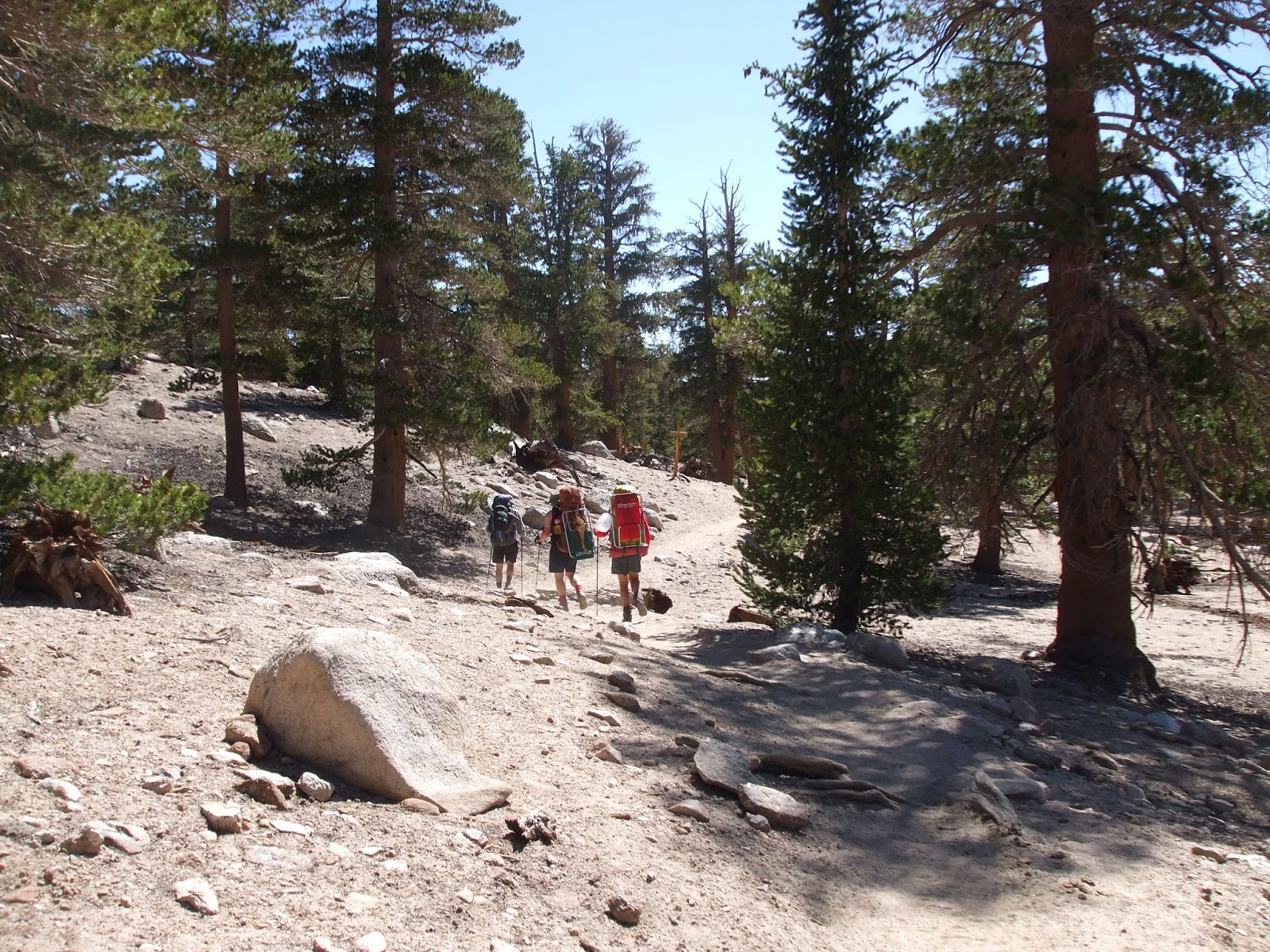
Ready to hike.

Now, there is off trail and then there is Off Trail; the hike up Rock Creek to Crabtree Pass is the former. There may be no official trail, but the contours of the land tend to funnel the traffic into a relatively orderly path, and there is enough traffic that that path begins to look like a regular trail in a lot of places. For example, one could go around Sky Blue Lake on the western side, but it is a steeply sloped jumble of irregular boulders and scree piled down to the water’s edge. The eastern side is flat with a pleasant meadow through which to stroll. No surprise then that the eastern side is the way most people choose to go.

Should there be a trail through Miter Basin? That’s a question we pondered throughout our stay. A trail would invite more traffic, which would add to the number of campers and campsites and general use, but there is already a lot of traffic and a trail might reduce the damage to the fragile meadows and tundra that all those people cause. Past Sky Blue Lake the trail would require a lot of maintenance, however, since the rocks are in constant motion and the trail would have to be largely rebuilt every year. So I guess on balance it is best to leave the area without an official trail, even though a trail could protect the most vulnerable areas.

The hike to Crabtree Pass is not difficult, although there are a few tricky spots. Perhaps the most challenging bit is the cliff face right below Sky Blue Lake. There are numerous ways to get to the top, and by traversing the slope just above the trees where we were camped, we could have avoided climbing altogether. But what fun is that? I found a neat little rock chute that offered a modest challenge without being too technical, Oliver and Rick climbed up the waterfall, and Snow Toad followed another chute that looked a lot like a rock staircase but with handholds and a 30 foot fall off to one side.

Sky Blue Lake is a strikingly beautiful lake, framed by rock slicks and tumbled boulders. The Miter rises above the lake on the eastern side, and to the north the land climbs steeply up toward Crabtree Pass. To the south one has a view of the Rock Creek valley and the Major General. 

The Miter.

Although beautiful, all of the camping at Sky Blue Lake is mediocre and in violation of the rules governing wilderness camping. There are flat spots, but all are within 100 feet of the water. That did not stop people from camping there, however. We came across one group that was camped on a rock shelf not more than 15 feet from the edge of the lake, and passed by another group that was camped on a large, flat rock that was surrounded by water on three sides. These campsites were scenic but exposed, and would have been miserable in any kind of inclement weather. But if camping on a rock-hard surface out in the open too close to the water’s edge is your kind of camping, then Sky Blue Lake is a place for you. 

Sky Blue Lake looking south.

From Sky Blue Lake the easiest path follows Rock Creek, which winds its way through a narrow valley. Just above the lake one has to scramble across a moraine and onto a granite shelf that defines the edge of the narrow valley on the southern side. It was while picking our way across the moraine that I met a father with his two adults sons hiking down from the pass. They had climbed over the pass and down to the Crabtree Lakes the day before, but the fishing was lousy so they had came back over the pass and were planning to camp at Sky Blue Lake. Although their mood was grim and they were not in a mood to talk, I did learn that there was a trail marked by cairns on the west side of the pass, but that they were hard to see on the way up because all the rocks just blended in. They also said there was a lot of sand, and that once over the pass it was more of the same on the other side.

I had to admit that this sounded pretty dreary, and as much as I wanted to say I had climbed over Crabtree Pass, I did not want to say it so much that I wanted to climb over it twice or spend three days hiking out along the Pacific Crest Trail. I might very well have started lobbying to not climb the pass right then and there, but all of the other guys had pressed on while I was talking with the father and sons, and there was no one around to lobby.

Bits of well-trodden earth were evident in the sandy spots on the shelf, and an occasional cairn added to sense that we were on the right path. I watched Oliver and Snow Toad and Rick disappear over a small rise of sculpted granite, but when I reached the top, they were nowhere to be seen. From my vantage point I had an excellent view of a large, deep lake nestled between steep walls of granite on the eastern and western sides. The shelf we had had been following formed the southern edge of the lake; to the north a steep slope of jumbled rocks and sand and scree continued on up toward the pass. At first glance, the trail appeared to continue in a northerly direction over the rise and around the west side of the lake, and I figured that was where my three companions were headed. But closer inspection suggested otherwise.  

Climbing the moraine.

From the top of the rise the ground fell steeply to the edge of the lake. There was no obvious way down without risking life and limb, or at least a quick dip in the lake, so I continued along the top of the rise to the east, which slowly descended to the lake outlet. The outlet was dry, but there were plenty of footprints in the soft sand and cairns stacked up on the far side. From here I could see that the trail continued around the eastern side of the lake. 

MountainGuy Lake. Unnamed on the map, claimed as our own.

The eastern edge was very steep, and the trail descended down to lake level before climbing over a small promontory that jutted out above the water. From the top of the promontory a rough use trail scrambled across the steep scree slope and then back down to the water’s edge. I could just make out the outlines of a path on the far side of the lake that would begin the climb up to the pass.

It was now about 11:00 in the morning. My companions clearly had gone the wrong way once they reached the granite rise above the lake, and while I was supremely hopeful that they had come to no harm on the steep rock, I figured that in an emergency I would be more capable if my stomach wasn’t growling. So I sat down on a rock in the sun to eat and wait for their arrival. I am not sure if I could quite see the pass from my rock perch, but I had a pretty good idea of where it was, and nothing I could see looked like anything I wanted to do.

“We were wondering what happened to you,” said Oliver, as he came around the corner and found me relaxing in the sun.

“Well, by using my finely tuned sense of, ‘I don’t want to climb down that slick rock face,’ I was able to skirt the dangerous cliff and discover the relatively well marked trail,” I replied.

“Yes, but you missed a great chance to do some excellent, if unnecessary, climbing. Plus, I don’t think that we even came close to dying more than two or three times.” Oliver was positively ecstatic.

“Put it that way,” I said thoughtfully, “and I’m really sorry that I’ve been sitting here comfortably in the sun eating snacks.”

“An excellent idea!” Oliver sat down on the rock and started looking through his pack.

Rick and Snow Toad came around the corner and extended greetings, then they, too, sat down to eat.

A fine lunch spot.


“That’s the trail over there,” I said, pointing to the use trail climbing over the promontory. Follow that line there over that steeply sloped and unstable scree and boulder field, and then back down the water, and that’s how you get around. I’m pretty sure that’s the pass up there.” I pointed to ridge top at the head of the narrow valley.


“What is our reward for climbing over that pass tomorrow?” Oliver asked.

“We either climb back the next day, or we spend three days hiking out along the Pacific Crest Trail,” I responded.

“I don’t want to do that,” said Snow Toad. “And I don’t need to climb any further. My self-esteem will be just fine from here.”

“Mine, too,” Rick nodded in agreement.

Oliver looked up at the pass, measuring the effort-reward involved. “I don’t need to go any farther. And if we head back now, we can still make our tee time.”

The trip back from MountainGuy Lake, claimed as our own because the lake was unnamed on our maps, was pretty quick. Even so, we did not make the tee time. Fortunately, the course was not crowded, this being one of the middle days of the week—Wednesday, I think—so we were able to push our tee time back. But Wednesday is also laundry day. When traveling light, one of the luxuries left behind is that second pair of underwear and another set of clean socks. In the interests of hygiene, as well as avoiding the discomfort associated with seven-day-old undergarments, tee time had to be pushed back even further to accommodate the wash cycle.

Puffy white clouds had been drifting by throughout the day, and while the sun was warm, the air was chilly when a cloud obscured the sun. All of which is to say that clothing hung on a line to dry was not drying quickly, and Oliver was getting more anxious by the moment. Eventually he could wait no longer, donning his still damp clothing so he could go out and play golf. Rick was carrying a good bit more clothing than either Oliver or I, so he, too, was ready to play. However, while my underwear had dried enough so that I could dispense with the towel I had been wearing, my pants were still wet and I was in no mood to wear wet trousers.

“Just play in your boxers,” Oliver chided. “Who’s going to see?”

“No one is going to see,” I replied, pretty sure that a picture of me playing disc golf in skivvies would be posted on Facebook if I went out there. “I’ll just lounge around camp in my underwear drinking coffee until my pants are dry. Maybe I’ll join you for a second round when you get back. Ask Snow Toad. He can use my disc.”

“Don’t ask Snow Toad,” said Snow Toad. “He has some serious chair time scheduled, and he may have to take a nap, too.”

When Rick and Oliver returned 40 minutes later, my pants were dry. Oliver had beaten Rick by a stroke, and was leading two games to one on the Miter Basin Tournament Course. This next game looked to be a bit of a grudge match. 

Disc golf warriors.

The first tee started behind a rock in the kitchen area, or rather a line between the rock and that tree, or actually anywhere in the vicinity of either the rock or the tree. Considering this was their fourth time playing this course, a lot of the particulars were still unsettled. This should have been a clue.

The first hole required a tricky shot between the trees and down the hill to the stream, the target being a dead tree behind those two dead trees there. The stream was out of bounds. I threw last. My first shot was a good one, leaving me in a good position to birdie the hole. My second shot was even better, swooping around the two dead trees and hitting the targeted tree.

“Wrong tree.” Rick smiled. “We meant that tree there,” pointing to a small stump about six feet further on.

“Too bad,” added Oliver. “That would have been a nice shot.”

And so it went. Every time I made a good shot, the target would change due to some unfathomable misunderstanding about the object in question. Oliver and Rick professed to being perplexed. Neither of them could remember having such a hard time describing a course, and they were insincerely apologetic throughout. I think I finished about 36 strokes back after nine holes. I suspected foul play, but the only other witnesses weren’t talking. As for the grudge match, Oliver took the last game by a stroke on the ninth hole, when Rick’s tee shot took off and ended up in a bush.

The clouds that had been drifting by all day thickened up in the late afternoon, and a smattering of rain started to fall about 5:00. Snow Toad was already in his tent, and the rest of us took the rain as an omen to follow suit. Oliver was concerned about his burrow tent, which he had once again located amongst the roots of a large tree, fearing that in a heavy rain he might end up in a small pond. Fortunately, the rain never amounted to much, and as soon as it passed on, Oliver was out of his tent building a series of dikes and ditches to channel the water away from his burrow. The effort netted Oliver the Army Corp of Engineers badge, with environmental epaulets for the sustainable design and use of all natural materials.

Dinner that night was a delicious butternut squash ravioli in marinara sauce, followed by cookies and chocolates for dessert. Snow Toad had ramen. 

Kicking back for dinner.

Tuesday, April 16, 2013

Miter Basin, July 2012, Day 4


Day 4: Middle Soldier Lake to a Bitchin’ Spot Just Below Sky Blue Lake, or We Don’t Need No Stinkin’ Trails! (3 miles)

We were greeted by mellow, MountainGuy Oliver when we woke up that third morning. He did not get up at 6:00 in the morning, and he was not packed and ready to go at 7:30. Corporate Oliver had finally decided to take the rest of the week off, and for that we were all grateful. Even without the grumpy drill sergeant, our experience and professionalism were discipline enough, and we were ready to hike by 9:00 a.m.

Even now our plans were in flux. Our goal for the day was to hike into Miter Basin and find a good campsite, but beyond that all was uncertain. We could hike over Crabtree Pass at the far northern end of Miter Basin, and from there down to Crabtree Lakes and Crabtree Meadows. But once at Crabtree Meadows our only choices would be to turn around and hike back over Crabtree Pass, or to return via the Pacific Crest Trail. Snow Toad and I hiked that section of the PCT the year before and found little to recommend it. So aside from going over Crabtree Pass (12,600 feet, all off trail), that option looked like a lot of work with scant reward. A second idea was to hike out of the Basin to the south, and head into the Golden Trout Wilderness. This would open up a lot of interesting possibilities, all of them featuring a lot of hiking in places with little water. Finally, we talked about taking a layover day in Miter Basin, and then revisiting the issue with one less day to work with.

From our campsite at Middle Soldier Lake, we hiked northwest through a heavily wooded section on the lower flanks of the Major General, a large promontory that guards the southeastern entrance to Miter Basin. We started out following a faint use trail that wound its way through the trees above the lake, but the problem with use trails is that one never really knows where they go unless one has been on them before. In this case that trail petered out at the edge of a small meadow about a quarter of mile from where we started. In a wetter year, we probably would have had to climb around the upper reaches of the meadow, which even in a dry year was oozy and soft. On the far side of the meadow was as steep rock scramble, covered in loose stones and dense brush. Had we known better, we would have chosen hiking down meadow rather than climbing up on the far side, but the thick forest and steep terrain meant we couldn’t really get a good sense of the lay of the land. And besides, who doesn’t love a good rock scramble, especially when covered in loose stones and dense brush? 

Scouting the rock scramble.

By the time we reached the ledge at the top of the scramble, we could see that our chosen path had taken us too high, and that traversing the meadow lower down would have led us to a trail and onto a nice little plateau across which we could have strolled into Miter Basin. But there was no turning back now, because that would be what sissies and smart people do. I think we climbed halfway to the top of the Major General that morning in an effort to maintain our elevation so that we would not have to hike up what we had just hiked down. The view was excellent, but as a practical matter, all that our efforts produced was an opportunity to climb down all the elevation that we had just climbed up.

Climbing up now so we won't have to later. (Photo ST)

Miter Basin is mostly above tree line, windswept, barren, and starkly beautiful. The basin is ringed on both sides by peaks that are well over 13,000 feet tall, and in the center of it all is The Miter, a fortress of rock that is 12,770 feet high. Most of the rock in Miter Basin is granitic in origin, but despite the massive scale of the mountains and the hardness of the granite, the entire landscape evokes a certain fragility. The landscape feels old, though by geologic standards, the entire Sierra Nevada range is quite young. Tumbled piles of massive boulders and small stones and deep sand clothe the lower reaches of the towering mountains, evidence of rapid erosion and the impermanence of all one sees. Dozens of lakes are found in Miter Basin, several of them quite large. Some of them contain fish. Down the center of the basin meanders Rock Creek, following the crooked path of an old river with time to dawdle in deep pools and narrow byways. There were many fish in Rock Creek when we arrived. Miter Basin is a happy place.

Strolling into Miter Basin. (Photo ST)

At the head of the main valley, just below Sky Blue Lake, is one small stand of foxtail pines, out of place and well above tree line, the last vestige of evergreens in a sea of rock, willows, and alpine tundra. Rock Creek flows out of Sky Blue Lake and across a rocky shelf before careening over a small waterfall and down to the valley floor as a thousand rivulets and a wall of trickling water. The stand of trees is immediately to the east of the waterfall, a tiny bit of shelter in an otherwise vast and open landscape.

A thousand trickles equals one waterfall.

There are two campsites in the stand of trees. One is down at the edge of the meadow, and the other is well up the steep slope and well hidden. Rick and I arrived at the first campsite and set our packs down, a little disappointed that this mosquito-infested flattish spot would somehow qualify as “good” camping. Poor to fair, perhaps, but not good. So I left Rick to casually swat mosquitoes and watch for bears while I set out to scout up the hill to see if there was anything better. The news was good on several fronts. First, the higher I climbed, the less dense the mosquito population, and second, about 150 feet up the hill was a fine little site, or rather, a small shelf in the hillside that harbored several flat tent sites, an open spot for our kitchen, and an excellent view of the Rock Creek valley through the trees. We could even hear the tinkling of the waterfall in the background. The only thing that prevented us from achieving complete jubilation is that we would have to take back all of the nasty things we said about the helpful hiker we had met the day before.

Excellent campsite up in the trees.

Our arrival at the site coincided with lunch, which was both timely and a testament to our overall lack of hiking ambition. None of us was interested in hoisting our lightweight packs and hiking any further. When Snow Toad announced that he was going to take advantage of our early arrival and day hike to Iridescent Lake, both Oliver and Rick were quick to sign on. However, I had other fish to fry, or rather I had seen fish in the creek that I wanted to fry, so I stayed behind to get my gear together.

With the other guys gone, the woods came alive. I could hear the waterfall in the background, the flies buzzing about, and the wind whispering through the trees. I sat back to listen, but mostly what I heard was the wind telling me to take a nap. My tent was warm from the sun, and lying down felt mighty good. When the wind offers such excellent advice, best take it.

That is how the other guys found me when they returned to camp. My fishing gear was out and ready, and I was in and asleep. My napping did not last through their arrival, which was heralded by the sound of 10,000 trumpets, or the MountainGuy equivalent of that. They were laughing and stomping and snorting and talking, excited to be back and happy to have gone. I imagine there was some general enjoyment at my expense, but as soon as they quieted down enough to hear the wind, they too could see the wisdom of the wind’s advice. So the last laugh was mine, or would have been if I had been willing to get out of my tent to claim it.

Iridescent Lake. (Photo ST)

The fishing in Rock Creek, when I finally got there, was very good. The creek was running low and slow, and the fish were hungry and competitive. Most of them were pretty scrawny, too. The low water levels meant that many mosquito-breeding ponds were already dry by the first week of July, and there just weren’t enough bugs to go around. I had good success with mosquitoes (dry flies) and black ants (also dry flies), and with this one black ant fly in particular. Every cast seemed to catch a fish, even when all that was left of the fly was one small black feather and a hook. I caught thirteen golden trout altogether, and kept five, which we fried up and served on crackers as an appetizer.

Appetizer course. (Photo ST)

While I was fishing, Oliver and Rick were playing disc golf. The course ranged far and wide, starting from our campsite up in the trees, out over the stream, down to the valley floor, back and forth a few times, and back up to the campsite. There were rocks for tees and rocks for targets, there were trees as targets and tees between trees, and just like real golf, there were genuine water hazards and occasional cursing. I believe that they played 18 holes, or perhaps they were just really bad, because they were out on the valley floor a long time heaving and cursing and scaring the fish. 

When I returned to camp, Snow Toad was in his usual repose, which is to say that he was inside his tent. Snow Toad goes fast when he is hiking, but once in camp his lack of ambition is boundless. When not in his tent, he is in his chair with his stove on one side and his food bin on the other.

Oliver and Rick were sitting in the kitchen area, fashioned from an open spot amongst the trees that was too sloped for sleeping. Oliver was getting ready to make dinner, a project that was delayed by the arrival of fresh trout. Dinner that night was corn chowder, another in a long list of soups that seem promising but do not quite deliver as a main meal. Without bread or some other starch to fill out the menu, soups just don’t seem to have enough heft to really fill the belly when backpacking. Snow Toad emerged from his tent and took up station in his chair while we were eating the appetizer course, but he didn’t want fish and he didn’t want corn chowder. He was saving himself for ramen, accompanied by at least four cups of hot chocolate. I guess if you’re living large, you might as well go all the way.

With dinner done, we had finally reached a decision point. We could stay in Miter Basin another day and do some day hikes, or we could pack up and climb over Crabtree Pass. If we took a lay day in Miter Basin, we would still be able to hike over the pass the following day with enough time to hike back to the trailhead along the Pacific Crest Trail. After much deliberation, the decision was finally made. We would day hike to the top of Crabtree Pass and check things out tomorrow. If we liked what we saw, we’d hike over the pass the following day.

Sunset on the peaks above Iridescent Lake.